Just a three-hour drive east from Pretoria and Johannesburg lies one of South Africa’s most stunningly beautiful regions – the Mpumalanga (pronounced: Mmm-poo-ma-lan-ga) lowveld.
‘Lowveld? But it looks so high!”, you might be thinking.
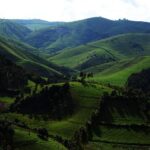
Although upwards of 2,000 metres high in many places, the region is called a lowveld (‘low bush’ in Afrikaans) because, geographically speaking, it’s the start of South Africa’s Great Escarpment, where the grassy highveld plateau plunges down into the savanna of the Kruger National Park. And in between: the Drakensberg mountains.
After getting Maggie back from the overland outfitters last week, we took a drive through the Panorama Route, one of the main attractions of the lowveld, and the speculor panoramic views certainly lived up to the hype.
We used this site to make our way through all the attractions of the route, but with some modifications. You can read about our route below, and follow on the map at the end of this post!
Long Tom Pass
View from Long Tom pass
View from Long Tom pass
Stay on R37? But we’re in a Land Rover!
Stay on R37? But we’re in a Land Rover!
Success! We made it to the summit.
Success! We made it to the summit.
Most tourists choose to enter the Panorama Route from Nelspruit – but not us. We’re not normal tourists, as Noel won’t stop reminding me. We entered through the Long Tom Pass, which sits between Lydenburg and Sabie.
The road through the pass peaks at 2,138 metres – climbing and descending an impressive 700 metres along the way. The pass is also lined with pine tree plantations, and stunning panoramic views of the mountainous and sub-tropical Lowveld region.
Land Rovers aren’t known for their uphill speed capabilities, but Maggie drove the pass like a champ (even though she never got to 4th gear on the way up!). We spent our first night at a caravan park near Lydenburg, to make sure that we drove the pass during daylight hours, but decided to give the historical sites of the town a miss – we’re not big Boer War enthusiasts.
Sabie & the waterfalls
Camping at Castle Rock Resort (with the place to ourselves!)
Camping at Castle Rock Resort (with the place to ourselves!)
Taking in the scenery
Taking in the scenery
Mac Mac Falls
Mac Mac Falls
The second stop on our self-drive tour was Sabie, a small but nice town on the Sabie River and in close proximity to three impressive waterfalls: Sabie, Bridal Veil and Mac Mac Falls. After finding a nice spot in Castle Rock Resort, a municipal community campsite next to the popular Merry Pebbles Resort, we set off for a trek through the bush to see some waterfalls and took in some beautiful scenery along the well-marked mountain bike trails.
In the morning, we enjoyed a delicious breakfast at Petena’s Pancakes. Apparently, pancakes are South African’s favourite holiday time treat, because the Panorama Route is full of pancake houses.
Onward and upward we went, passing through Graskop to visit the Mac Mac falls (pictured above). This is also an excellent place to do some souvenir shopping, as the car park is full of vendors selling all kinds of African handicrafts.
Blyde River Canyon
View from God’s Window
View from God’s Window
Maggie stops for a rest outside a village in the Blyde River Canyon
Maggie stops for a rest outside a village in the Blyde River Canyon
View of the Burke’s Luck Potholes
View of the Burke’s Luck Potholes
After leaving Sabie, we decided to give Pilgrim’s Rest a miss (we still haven’t warmed to Boer War history) and continued north through the Blyde River Canyon (also known as the Motlatse Canyon).
And, boy, was it stunning. This canyon claims to be the third largest in the world – bigger, in some respects, than the Grand Canyon in the US – and is extremely lush. Not what many people picture themselves experiencing on an African safari trip.
There are a number of gorgeous viewpoints on the 70km drive north along the edge of the canyon, including God’s Window, the Three Rondavels, and Bourke’s Luck Potholes, where years of water flow have carved out huge holes in the limestone rock that resemble potholes (pictured above). Entry to all of these viewpoints is reasonably priced between R10 and R30 per person.
We ended our long and hot day under the canopy of the canyon at the Swadini Forever Resort caravan park, which has fantastic showers to add to the incredible view.
Hoedspruit, Hazyview and White River
Ok, so we didn’t drive the whole Panorama Route in one go. To be fair, most tourists explore the lowveld on the way to or from Kruger National Park, and so did we. We left the Panorama Route in Hoedspruit, entering Kruger from the Phalaborwa gate (post to follow soon).
But when we left Kruger, we decided to complete our circle by driving through Hazyview and White River. Both towns are stunning. And this part of the drive differs drastically from the first half, in that the views are lined with villages, settlements and small towns.
A beautiful and fun drive that Noel frequently exclaims is his favourite in South Africa! So far, anyway
